Throughout history, man has continually invented new ways through which to communicate. Because we are a visual animal, many of these methods involved some sort of imagery. Markings on cave walls tell us today that even in our most primitive times we relied upon drawings to convey our messages. Of course, since caves are hardly portable, animal skins, papyrus and eventually paper and canvas became media for transporting and sharing these symbols. Postcards have little space to write more than the obligatory, "Having a wonderful time, wish you were here," because they don't need it; the photo on the front depicts the bulk of the experience.
Movies, TV and the Internet have taken visual communications from a static to an active role, to the point that wireless telephones have become a mechanism for taking snapshots and movies and for viewing streaming videos. Maxims such as, "one picture is worth a thousand words," and "every picture tells a story" dot our language. The fire service itself has had a lengthy association with visual records, although throughout our history much of this has taken the form of recording events by artists such as Currier and Ives and photographs used by arson investigators to document evidence. Training diagrams, slides and videos have also consistently been a part of how we learn to do things in the classroom. However, for a very long time, the bulk of our visual involvement dealt with concerns other than response.
Perhaps the first change came with the advent of the pre-plan. Somewhere, somebody once got the idea that visiting buildings in the first-due area before they actually catch on fire was a good idea. What might have started out as a few hastily scribbled notes and some crude diagrams has now morphed into the ability to store, share and interactively update data and blueprints concerning the target occupancy. While many agencies still effectively keep hard copy plans stashed in the rear of the command vehicle, an increasing number have turned to storing electronic copies at central locations or on laptops.
Building information can become an integral part of computer-aided dispatch (CAD) systems, where it can be remotely updated by fire inspectors in the field. This information can be transmitted across a fixed-data or wireless network during an alarm automatically or selectively shipped on demand in response to a user request. These images can help the dispatcher in visualizing the emergency scene; a benefit not often considered. Their primary use, of course, is to directly support decision making and operations on the fireground.
Centralizing these and other images requires appropriately sized disc space, as well as communications links that are sufficiently robust to transfer large files in a few seconds or less. In the past, this was somewhat problematic, because mobile data terminal (MDT) networks often ran at less than half the speed of an average dial-up connection. And, since the graphic files are significantly larger than the "thousand words" they replace, many agencies took to providing compact disks (CDs) to make the data available in the field. Digital video disks (DVDs), thumb drives and other portable media further increased this capacity. This saves bandwidth, and soft-copy storage obviously has several advantages over paper; it requires less space, it can be more quickly updated, it's cheaper and there's no ink to run if it gets wet. Regardless of the source, electronic blueprints coupled with emerging firefighter accountability hardware and software have the promise to provide remote real-time tracking of crews inside the fire building.
Improvements in communications systems have also created the ability to move more data than ever before, making wireless distribution of larger files more practical. Included here are the recently opened 700 MHz band, which utilizes frequencies vacated by TV stations, and mesh networks that use either a series of fixed routers or daisy-chain portable computers to relay the appropriate files.
The 1990s issued in the era of digitally accurate maps, which replaced many of the old standby pull-down variety that typically graced most dispatch centers and fire stations. Initially, their benefits came from the fact that they could be more quickly updated and shared. With a paper map, official changes weren't made until the manufacturer issued the next edition. However, it was not uncommon to see dozens of hastily hand drawn lines that tracked the community's growth since the last publication. Electronic maps allowed everyone to play off of the same sheet of music. An update made by one became available to all, thereby reducing a significant amount of work formerly spent on keeping dozens of different documents current.
While some of these maps existed solely in the geographic information systems (GIS) realm, many became attached to CAD computers. Here, additional "layers" could be displayed, much like the transparencies once used as overlays. One common practice was to import water-distribution grids that contained hydrant locations and the sizes of mains. Another was to add storm sewer plots in order to predict and control runoff of hazardous spills. But nowhere did mapping become so critical to the Public Safety Answering Point (PSAP) as it did in support of wireless 911.
Since cellular callers have no fixed address, locations are relayed by means of latitude/longitude coordinates. Because dispatchers can't typically dispatch units to locations that are presented in this fashion, an alternative method must be provided in order to display the call. Enter the digitally accurate electronic map, in which street centerlines correspond exactly to global positioning system (GPS) measurements. Through this utility, inbound requests appear as visual flags or icons, and an approximate street address can be discerned.
An even more recent entry into the technology market is oblique orthography. While aerial photographs themselves are nothing new, oblique images are taken at fairly high resolution and at an angle, offering an almost three-dimensional result. Whereas most overhead photos in the past showed little more than a view of the roof, every side of the building can now be seen, making this a valuable asset for both telecommunicators and incident commanders. In addition to the visual component, which can aid in both checking landmarks on the initial call as well as quickly displaying exposures, measurement tools are provided that can assist in determining the length of required hoselays or which buildings are within an evacuation perimeter.
Traffic cameras have become an increasingly popular presence inside the dispatch center. Whether accessed by the Internet from commercial websites such as those provided by TV stations or through a direct fiber hookup to a city, county, or state transportation system, they provide upfront information not previously available. Even when incidents are not directly within view, traffic conditions to and from the incident can be monitored, and units can be provided with alternate response routes as necessary. In a similar fashion, some communities have installed surveillance cameras in target areas throughout their jurisdictions. While often designed primarily for law enforcement purposes, these too can be put to fire service use under the appropriate conditions.
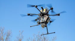
Next-generation 911 will add yet another visual component to the mix; that of imagery coupled to the initial call. Since many wireless devices now serve as cameras in addition to telephones, this is the next logical step in providing as much information about the incident as possible. In the field, this capture and display of data can include sources such as helmet cams, and remote video of the incident displayed real time in the command post. Before the fire, it can be in the form of digital photos taken during the inspection process.
In a world where games rely on virtual reality, it makes sense that the serious business of firefighting should take advantage of tools that maximize the use of visual data. The author Arthur C. Clarke once said, "Any sufficiently advanced technology is indistinguishable from magic." While our increased use of imagery is certainly not smoke and mirrors, it would doubtless seem like an illusion to our forefathers who relied upon following the glow in the sky.
--Barry Furey