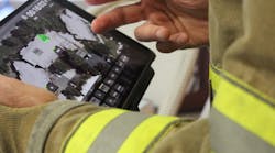
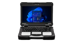
IncidentView, by Alsea Geospatial, Inc. (AGI), is First Responder mapping software.  IncidentView finds response locations by address, intersections, landmarks and coordinates.  Clickable dispatches are displayed in a popup which zooms the map to the response location.  Tactical information such as hydrants, stand pipes, KnoxBox, and pre-plans is displayed on the map. Real time AVL displays responding vehicles, including yours, on the map.  IncidentView is currently available for Windows, iOS, and Android.

Request More Information

By clicking above, I acknowledge and agree to Endeavor Business Media’s Terms of Service and to Endeavor Business Media's use of my contact information to communicate with me about offerings by Endeavor, its brands, affiliates and/or third-party partners, consistent with Endeavor's Privacy Policy. In addition, I understand that my personal information will be shared with any sponsor(s) of the resource, so they can contact me directly about their products or services. Please refer to the privacy policies of such sponsor(s) for more details on how your information will be used by them. You may unsubscribe at any time.