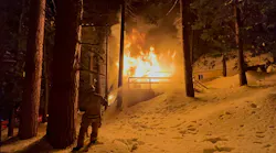
One of the most difficult things to prepare for as an incident commander can be summed up with the word mayday. In a career that routinely operates with calculated risks and uncertain/unfamiliar structures, hearing this come across the radio lets everyone know that a firefighter is in trouble and needs help. Everyone who is on scene hopefully has maintained great accountability practices to include tracking who is in the structure, where those people are located and how long that they have been operating on the limited air that they carry on their back. Even the best-prepared teams must rely on their training, knowledge of tactics, understanding of building construction and, maybe, some options, such as pack tracking and/or telemetric systems, to find someone. In a moment that can rattle even the most battle-hardened firefighter, every second counts if there’s going to be a positive outcome.
Luckily, thanks to investments including the National Institute of Standards & Technology (NIST) grant-funded FRST 3D Tracking Challenge, innovations are providing new tools to help to find first responders.
Technology limitations
As someone who loves to check in on the latest advancements and innovations to improve firefighter safety, the ability to know where everyone is physically on an incident scene intrigued me. Several existing options provide the capability to track a location of a firefighter, but they all have one major limitation: They can’t track the z-axis, or vertical positioning, of a firefighter withing a one-meter accuracy without predeployed technology.
I remember the first time that I used tracking technology on a complex training scenario that included a multilevel structure. With one option, we tracked the signal strength until we got to an empty room and realized that the person who we were looking for was above us. In a real scenario, the time that was spent to get close to a downed firefighter could have ended poorly.
The other option that we used let us know how far away from each other that we were and showed the available air pressure in our SCBA cylinders. However, without a frame of reference or the ability to access the information away from the command vehicle, it wasn’t useful intelligence.
Ultimately, tools are only as good as their limitations and the people who use them. However, at the time, this technology was a better solution than being truly unaware of where someone was located.

The challenge
NIST has provided competitive grant opportunities and works with industry and academia to enhance economic security and improve quality of life. A relatively newer approach to fostering innovation—rather than requiring an extensive grant application process for the actual innovators—NIST released a notice of funding for a challenge. Indiana University’s Crisis Technologies Innovation Lab (CTIL) won this grant that was a part of an $8 million initiative to improve tracking technology for first responders.
The CTIL crew, which is led by Dr. Sonny Kirkley, quickly built a team of industry experts, judges, innovators, marketing professionals, members of academia and students to create the perfect environment to plan, design, build and test innovative solutions.
This competition was named the FRST 3D Tracking Challenge. Although there were several performance standards that elevated through each of the five phases of the challenge, the focus included four main goals: By the end of the challenge, the winners had to demonstrate the ability to create a scalable and affordable option that could track a person on the x, y and z axes without predeployed technology (no smart-building options) and that was accurate within one meter.
The FRST 3D Tracking Challenge started in March 2022. Throughout the challenge, competing teams were supported by subject matter experts, first responders and industry professionals to help to guide their development process.
Early phases judged results and data from testing that was completed all over the United States by fire departments that were in the vicinity of each competitor. The final phase was a live test at the Muscatatuck Training Center, which is a 1,000-acre urban training facility that’s located near Butlerville, IN. It has 120 training structures and more than one mile of searchable tunnels.
To aid in the testing, first responders from the Columbus, IN, Fire Department, the Indianapolis Fire Department and the Bedford, IN, Police Department were on sight to go through the testing scenarios that added real-world challenges.
In the end, each winner successfully navigated a course that included limited visibility and various methods for traversing elevation changes.
The winning teams
The final live-testing phase was completed by six teams. The top two teams, Ascent’s Smart Firefighting Collective and AdaptiTrace, each received $500,000 for their performance in the challenge. Although the top two teams took a large portion of the prize money, a total of $1.9 million was split between the six finalists.
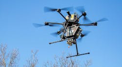
According to Kirkley, two core technologies prevailed: physical sensing and sensor fusion (combination of optical and physical sensors). Throughout the previous phases of the competition, advancements also were witnessed in cellular, Wi-Fi, ultra-wideband, mesh network, camera and lidar-based technologies, which can enhance emergency scenes of the future.
For the top teams, the prize money was provided to help to take their solutions to market.
The challenge created multiple viable solutions that will be on the market for firefighters to use. At press time, some of the contestants already partnered with large companies that are in the business of providing firefighting equipment. Market conditions, unknown testing requirements and other factors might affect the timeline to physically hold one of the options in your hand, but one thing is for sure: The ability to know the precise physical location of someone at an emergency scene is a reality.
As a subject matter expert for the competition, I was reminded how resourceful people can be when they focus on how to overcome a problem. The healthy competition pushed teams to be more accurate, ease user interfaces and truly test the limits of technological advancements to benefit firefighter safety.
Tech revolution
Firefighters and other first responders often are risk-averse, particularly when it comes to new technology. Further, the age-old traditions and methods that are a foundation of the services that we provide aren’t ready to become obsolete, nor would I advocate for overly relying on technology. However, if our predecessors failed to put faith in advancing technology, we still would use buckets of water and horses. If technologies that come to the fore never are adopted, we also limit the evolution of this kind of technology.
Advanced telemetric systems coupled with biometric monitoring and robust communication platforms can revolutionize how departments operate at emergency scenes. Beyond helping to forward the investment in our career, imagine the lives that could have been saved if the RIT team knew the exact location of a trapped firefighter.
If you still are unsure whether options such as these are right for you or your department, read the “Five Questions for Tech Solution Success”. If you or your department are progressive enough to become early adopters of technology, establish a relationship with the innovators to serve as a source of feedback.
If the FRST 3D Tracking Challenge proved anything, it is that, with the right conditions, anything can be possible.