As emergency services providers, we are well aware of the need to obtain a good address – something that has been problematic with cellular telephones since their introduction to the public market two decades ago. Emergency communications personnel have long been frustrated by the “mixed blessing” of wireless devices. On the one hand, persons needing assistance on limited-access highways and in remote areas benefit from the ability to immediately contact help. On the other hand, these cellular calls have historically been delivered without location information – a key point of conventional enhanced 911 (E-911) that came to be routinely expected.
For many years, wireless 911 calls provided the dispatch center with no more information than a conventional call dialed to a seven-digit office number. Recently, however, things took a turn for the better with the rollout of “Phase II” of the wireless implementation plan. Phase II calls deliver both the Automatic Number Identification (ANI) and Automatic Location Information (ALI)) components that have long been a feature of E-911 on conventional telephones. However, that being said, there are still issues with which municipalities will have to deal.
First, the presence of Phase II is not automatic, nor is it widespread. It is estimated that about 20% of existing Public Safety Answering Points (PSAPs) are presently capable of providing this service. Obviously, this means that the vast majority are not. To get to this level, an agency must file a written request with the cellular carriers to provide service, and must have internal equipment that can translate and plot the latitude and longitude data attached to the call. In some states, these requests are filed by the state themselves, and in others it is an individual responsibility. In any event, the local dispatch center will most likely be responsible for the cost of making the required on-site upgrades. Depending upon the state and age of current devices, this can range anywhere from a minor software update to a total replacement of telephones, Computer-Aided Dispatch (CAD) and mapping.
Because enhanced wireless addresses are delivered in the longitude-latitude format, some system must be in place to convert these coordinates into a more recognizable address. For agencies involved in wilderness or water rescue, the availability of Global Positioning System (GPS) coordinates is a plus, but for calls located on dry land there has to be some mechanism to translate these digits into a commonly recognized form of address. Some may argue that this can be done with a paper map or set of files, and this is true. It can also be argued that you can measure your backyard with a six-inch ruler and obtain accurate results. Both statements are true, but unless you are talking about a small area, you are probably going to want a more efficient mechanism by which to obtain data.
In this regard, a digitally accurate map is important. Even if you currently have a computerized Geographic Information Systems (GIS) file, it is critical to assure that all street centerlines and major commonplace records carry with them the correct latitude and longitude. Failure to do this will render any reporting system next to useless. Improving the CAD system to allow for an automatic interface is another step that should be taken, as wireless providers utilize different data formats, which are all different from the existing wireline. Because there are normally multiple cellular carriers in any given area, a similar number of “masks” will be required for seamless data translation.
Once Phase II service is established, significant testing should be undertaken to determine the accuracy. In all probability, every carrier will not come online the same day, so there will be a period of time when the PSAP will be receiving a mixed class of service. The facility that I manage in Knoxville, TN, has been Phase II compliant since December 2003. Our experience with testing and real-time service indicates that there can be some discrepancies between providers, and calls from the same location with a group of competitors’ telephones have resulted in slightly different coordinates being received. However, the nature of the technology is such that wireless E-911 provides only an approximate location. This is another aspect of Phase II that must be understood by the fire service.
Whereas conventional E-911 provided pinpoint accurate addresses, it was able to do so because the telephones being tracked were all tethered to copper cables that never moved. Installation records were capable of providing addresses down to the room level. Wireless, by nature, is portable. It isn’t tied to anything. Vendors are free to choose between competing technologies that use either a handset-based GPS chip or a system solution that reckons the location of the telephone. Both methods are subject to conditions that can affect their accuracy, such as calling from a hardened building or underground parking garage.
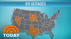
There are also many pieces of the technology puzzle that must operate together to provide an end-to-end solution. In July 2004, one company that provides location information for wireless companies announced a temporary database outage, while another major provider turned off its Phase II solutions over concerns that a glitch may be causing premature termination of 911 calls.
Current federal standards call for 67% of network calls to be within 100 meters and 95% to be within 300 meters of the actual calling location. Handset solutions have a more stringent set of goals, with 50 meters and 150 meters being used as benchmarks, respectively. While most agencies report better real-time experience, keep in mind that 100 meters is about the length of a football field, including the end zone. Divergences of this magnitude can easily place the call on another street or in another building.
Given this, call takers must be especially aware of the need to thoroughly interrogate wireless callers to assure that a proper address has been obtained. Included here also is the fact that wireless locations do not provide a height element, which can be problematic when dealing with multiple-story building or with overpass/underpass situations. Although handset solutions are required to be more accurate, agencies must remember that until all handsets are upgraded to include GPS chips, companies using these solutions cannot provide universal Phase II data. The deadline for the replacement of non-GPS handsets now stands at Dec. 31, 2005.
One final difference between enhanced wireless and enhanced conventional 911 is the delivery of data. While the name and address of a conventional caller flash on the screen instantaneously as a landline E-911 call is answered, dispatch personnel must wait to perform a “rebid,” or send a request through the equipment to receive the wireless location. In many instances, this data may not be available for 15 seconds or more, and may require multiple rebids to retrieve. This is especially agonizing for public safety personnel dealing with caller in crises who have absolutely no idea of their locations. Perhaps wireless location data would be better termed “SALI” for “Semi-Automatic Location Information.”
Despite its faults, Phase II provides the fire service with another tool in the delivery of timely and accurate response. However, as with any tool, we need to become familiar with both its strengths and its weaknesses in order to put it to the best use.
Barry Furey, a Firehouse® contributing editor, is executive director of the Knox County, TN, Emergency Communications District. He is an ex-chief of the Valley Cottage, NY, Fire Department, ex-deputy chief of the Harvest, AL, Volunteer Fire Department and a former training officer for the Savoy, IL, Fire Department. Furey is president of the Tennessee chapter of the Association of Public safety Communications Officials (APCO). He also was conference chair for the 2002 APCO International Conference in Nashville.