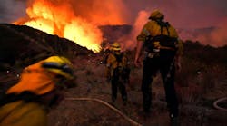
As the fast-moving wildfire advances toward a rocky ridge entangled in bone-dry underbrush, a copse of Ponderosa Pine and a dozen homes, the incident commander looks to his operations chief and gives the order, “Launch Little Bird 1, and give me an update on weather and resources.”
Simultaneously keying his radio and prodding a touchscreen, the operations chief executes the order and has wind, humidity and incident weather forecast within seconds. A nearby unmanned aerial vehicle (UAV) pilot, using hybrid laptop and control panel tied to a directional communications link, fires up the quad copter’s electric rotors and uses a joystick to gain altitude and speed of the fragile-looking helo.
A few minutes later, the laptop’s software receives the small, battery-powered helicopter’s video feed from 500 feet aloft as it flies a predetermined GPS-guided route around the fire. The software processes the image and overlays a local topographical chart with a Google Maps image. Then, with a couple of clicks, the operations chief views a three-dimensional image of the fire, its predicted path and estimated resources required to bring it under control.
Coming soon
This seemingly futuristic view of combating a hypothetical wildfire is a sample of what is on the horizon for fire departments nationwide. Although federal government regulations have throttled the use of the unmanned vehicles, they are poised to become a common tool for incident commanders working a variety of major scenes. And university-based UAV researchers and software developers are moving swiftly to deliver a complete system to first responders.
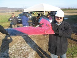
Dr. Kelly Cohen, principal investigator for University of Cincinnati’s SIERRA project, sees a clear need for unmanned aircraft to help incident commanders identify and predict large scale incidents. He cites Colorado’s Waldo Canyon Fire as an example.
“I was at the Air Force Academy at the time and was given the evacuation order for what turned out to be the largest wildfire in Colorado’s history,” he said. As a result, “I started to wonder how technology could be used to exploit something like a fire of this magnitude. Having eyes over a fire is really a powerful tool” for firefighters, he said.
SIERRA, an acronym for Surveillance for Intelligent Emergency Response Robotic Aircraft, is one way the University of Cincinnati is applying UAV technology to reduce the disastrous effects of wildfires.
“My team is looking at taking video information, geographical data from the fire, and integrated them with information about the landscape, vegetation and fuels,” Cohen said. “(Then we plan to) take a GIS database, satellite images of the area, and weather predictions from NOAA and put them into software that displays information real time.”
“In the case of the Colorado fire in the Mountain Shadow neighborhood, in which 350 homes burned down, the first few days of the fire it was contained to a valley, and the resources used were rather minimal,” Cohen said. “Then, with the introduction of 50- to 60-mile per hour winds, the whole event changed. When the incident commanders (were later) asked what happened, they said they weren’t expecting this outcome. But when you have prediction capabilities, then you can look at worst-case scenarios – and there’s a good chance you would realize the potential of this fire and would’ve distributed your resources accordingly.”
Once we understand how a fire will behave in time, Cohen said, “we can predict a few days ahead. This gives you very good situational awareness. With simulations, we can look at attack strategies – how we can attack the fire, how we position or resources and do we have enough resources.”
He added, “If you look at wildland firefighting in the past 40 years, you’ll see a lack of situational awareness,” and that has been a problem. “The idea we have here is to develop a ground station with software capabilities that we can empower the incident commander to get a very good assessment of what is happening and what will happen using the simulation tools.”
State-based practical application
Cohen and West Virginia Forestry have formed a partnership to refine flight and software capabilities and tailor them to wildfire applications, according to Rodger Ozburn, one of three West Virginia regional fire specialists.
“It all started when a participant in the SIERRA Project took a wildland firefighting class from us and found out what was involved,” Ozburn said They were looking for some practical applications of unmanned aircraft in the fire service, he says, and the Division of Forestry saw the benefits to firefighting.
“I think (the technology) we are now seeing is pretty amazing. The platform flies well with an experienced pilot. The software has the ability for a user to program in a pre-designated fight path and provide video footage – in real time – which is pretty cool. It’s the ability to rapidly get eyes in the sky – that other perspective that you typically don’t have,” Ozburn said.
For Ozburn, whose response area does not have the capacity to put a manned observation helicopter in the sky, the UAVs’ rapid deployment capability and their low cost are impressive. From his experience, a $5,000 system is credible, but even a $30,000 bird with all the bells and whistles pales in price comparison to a Hughes 500.
“We don’t have aerial resources here. For me to get a helicopter in my area is almost impossible,” he said. “If we had this resource, it would be invaluable, especially if you can fly past the line of sight. The thing we’re really looking forward to is testing when a natural disaster occurs. We could do some reconnaissance from a given point and get a broad picture of just what kind of situation we are facing. Actually, I think if we would’ve had this technology in our hands in early November we could’ve prioritized our saw crews who were clearing roads after Hurricane Sandy.”
The partnership with University of Cincinnati edges his department closer to that day.
“Conceptually speaking, we’re trying to bring about a change by working with firemen,” Cohen said. “We want to make sure what we’re making here is not just mathematical equations on paper but something that will be fully functional in the field.”
Next: The potential for firefighting
