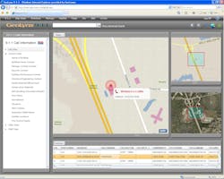
GeoLynx Server is a dispatch Web GIS application that enables tactical GIS dispatch within a public safety network. GeoLynx Server will seamlessly connect PSAPs, responding agencies, and mobile responders, increasing their ability to gather and share information, and respond to and track emergencies. It provides a common operating picture (COP) of your agency's geographic coverage area and emergency response activities for all web users to see and interact with. This helps to create a shared situational awareness for all users of the application.