The 19th Watchout Situation: Unfamiliar with Land Navigation Techniques
Everyone is familiar with the 10 Standard Fire Orders and 18 Watchout Situations. And there are probably a lot of wildland geeks like myself who claim to have discovered additional “watchouts.” That being said, I think what I have here is a little different.
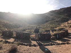
I recently visited the fatality site via the Granite Mountain Hotshot Memorial Trail. Seeing the actual location in person inspired me to reach more firefighters and convey the importance of land navigation as it relates to firefighting. My 19th Watchout Situation is “Unfamiliar with land navigation techniques and position not known.”
I’ve been teaching a Land Navigation for Firefighters course in San Diego for the past 5 years. I have always struggled to express why I feel so passionate about the lost art of land navigation, and why I think it’s an important skill for firefighters to know, especially for the wildland firefighter. A land navigation course isn’t required for any Incident Command System (ICS) positions or taskbooks, and most people really don’t care about learning how to read a map, use a compass or become efficient with a GPS. In fact, some people might say, “Why put in the time to learn all that stuff when I have my smartphone?” (I actually had a chief officer tell me that once.) This is also a common mindset among Millennial-generation firefighters who rely so heavily on technology.
So why take a 3-day course that doesn’t really apply toward any type of certificate program or give you any extra points toward a promotion? As firefighters, we should be training on any skill that could possibly save our lives, not just classes that offer a special certification. Unfortunately, sometimes it takes a tragedy to realize that a training deficiency is present.
Tragedy on Yarnell Hill
As I was researching one the components to my land navigation course, I came across audio of the final radio transmissions of the Granite Mountain Hotshots, just before they perished at the Yarnell Hill Fire in Arizona on June 30, 2013. Like most firefighters, I heard the recordings when they were initially released, but never really analyzed them other than thinking how horrible those moments must have been for those men just before the fire front hit them.
And to be clear, I’m not saying that those men didn’t know how to use a GPS receiver, nor do I claim to know what happened in the last few minutes before the burnover. No one knows exactly what happened in those last moments before those 19 men died, but we do have some audio of their final transmissions that can be used as a learning tool.
I debated on whether to use this example due to how much these brothers mean to wildland fire history. But when you review the 10 Fire Orders and 18 Watchout Situations, they stem from deaths that occurred at fires. Those orders and situations are not used to place blame of any wrongdoing or point out shortcomings, but instead are to be used as a teaching tool to prevent any future tragedies.
The Yarnell Hill Serious Accident Investigation Report and audio dictates the following as the last radio exchanges with the DIVS A (Granite Mountain) and an Aerial Supervision Module (ASM2):
DIVS A / Granite Mountain: “Breaking in on Arizona 16, Granite Mountain Hotshots, we are in front of the flaming front!”
DIVS A / Granite Mountain: “Air Attack, Granite Mountain 7!”
ASM2: “Okay, uh, unit that’s hollering in the radio, I need you to quit, and, ah, break, Operations, Bravo 33.”
ASM2: “DIVS A, Bravo 33.”
DIVS A / Granite Mountain: “Yeah, I'm here with Granite Mountain Hotshots, our escape route has been cut off. We are preparing a deployment site, and we are burning out around ourselves in the brush and I'll give you a call when we are under the shelters.”
ASM2: "Okay copy that. So, you're on the south side of the fire then?"
Granite Mountain Division Alpha: “Affirm!”
A Very Large Air Tanker (VLAT) was sent to the southern part of the fire, but a detailed location was never given to the air tanker while it was orbiting over the area where the trapped firefighters were thought to be located. At one point in the radio transmissions, ASM2 asks DIVS A to listen for aircraft to try to pinpoint the Hotshots’ position. With two heads on the southern flaming front, nearly 3 miles of open line, heavy smoke and an extreme rate of spread, it was impossible to make a drop on Granite Mountain’s unknown location. After that last communication from Granite Mountain, several more attempts were made to try to obtain the position of the 19 men. The bodies of the Granite Mountain Hotshots were found nearly 2 hours after that final transmission.
Know your location
In those radio transmissions, there was no mention of a fixed location. To be clear, there is no proof that a solid location given to Air Attack would have saved the Granite Mountain Hotshots, but a latitude/longitude coordinate of N34° 13.227' by W112° 46.650' may had given them a chance. It seems fitting that my proposed 19th Watchout Situation—Unfamiliar with land navigation techniques and position not known—be in remembrance of the Granite Mountain 19. Using a map and navigation tools to plot and measure coordinate locations of temporary refuge areas (TRAs), safety zones and potential deployment sites as you are hiking along the fireline could mean the difference between living and dying if you had to deploy your fire shelter.
What's your plan?
With the above information in mind, what happens if you do become trapped? We tend to focus on entrapment avoidance, but having an entrapment plan may help mitigate the situation. Both should be in the same planning process and wheelhouse as your 10s and 18s, LCES (lookout, communications, escape route) and PACE (primary plan, alternate plan, contingency plan, emergency plan). Specifically, what will your call for help look like when you face an entrapment?
In the structure fire world, mayday has become the universal term for a firefighter in trouble. We have a structured communication process to call for help when a firefighter becomes trapped or injured. This same concept should be applied to the wildland firefighter. This communication process needs to be specific and concise to minimize potential confusion. I propose the acronym LAND for this purpose:
· Location: Division and position (format: degrees, decimal, minutes)
· Actions: Deploying shelters, refuge in a home, safety zone, TRA, etc.
· Needs: Airdrop, medical emergency: (FEMP/REMS), hoist Ship, etc.
· Designator: Name of crew or engine, number of firefighters trapped, one person making the communications
The information in the acronym doesn't necessarily need to come in the order presented, but the content is vital. Firefighters should be in the mindset of practicing mayday communications and utilizing LAND every time they drill on shelter deployment.
Final thoughts
Please do not think this article is in any way shape or form meant to be negative. What I hope for is, if you think of the Granite Mountain 19 on this 5th anniversary, you think about this 19th Watchout Situation and hopefully take a second look at your map or GPS.
For more information on the 10 Standard Fire Orders and 18 Watch Out Situations, visit fs.fed.us/fire/safety/10_18/10_18.html.
About the Author

Damian Guilliani
Firefighter
Damian Guilliani has more than 20 years of experience in the fire service, currently serving as a firefighter with the Encinitas, CA, Fire Department. Guilliani is a situation unit leader on California Interagency Incident Management Team 4 (CIIMT-4) and is a technical information specialist on FEMA US&R California Taskforce 8. He is also ICS-qualified as a field observer, display processor, fireline paramedic, helicopter crewmember, geographic information systems (GIS) specialist, and single resource boss.
