FireFusion 2025: CAL FIRE's Technology is Advancing Wildfire Response
The California Department of Forestry and Fire Protection (CAL FIRE) protects 31 million acres of California’s privately owned wildlands and responds to more than 550,000 emergencies every year.
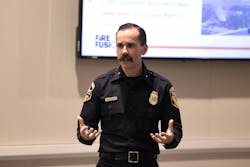
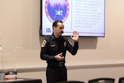
CAL FIRE’s Staff Chief Phillip SeLegue joined FireFusion 2025 to show attendees how CAL FIRE leverages a multitude of fire intelligence tools to support all phases of wildfire management.
The biggest goal for CAL FIRE is to keep fires small. Ninenty-five percent of all wildfires they handle don’t surpass 10 acres. They want to stay fast, aggressive and safe while integrating air and ground services.
SeLegue covered various technologies that CAL FIRE utilizes to stay in line with their goals. But, SeLegue stressed, predictive services plays a large role in preventing wildfires.
Predictive services
“Predictive Services gives us everything that we utilize on a daily basis for greater situational awareness, for enhanced situational awareness,” said SeLegue.
The predictive services play role in an ongoing assessment circle that contains its Wildfire Forecast and Threat Intelligence Integration Center integrated with FireGuard for persistent coverage and synthesization to CAL FIRE’s ALERTCalifornia to enhance situation awareness. This circle goes down to the tactical firefighter on the ground.
Part of the predictive services include CAL FIRE’s remote automated weather stations (RAWS). This gives CAL FIRE a weather information model system that can communicate with its fire emergency management system. With the 106 RAWS, CAL FIRE also have micro-RAWS that can travel into the field.
The Wildfire Forecast and Threat Intelligence Integration Center serves as California’s integrated central organization hub for communication that is also public data on an interactive website.
This helps with recognizing fire size potential, weather forecast, extended attack assessment and statewide wildfire risk potential.
FireGuard
CAL FIRE’s FireGuard technology started with the purpose of early detection and ongoing assessment.
“I pushed for FireGuard for early detection and ongoing assessment, because we've never had consistent coverage of the state from when a fire actually starts all the way through the life cycle of the fire,” said SeLegue.
It integrates all source intel officers into CAL FIRE’s intel program, and they look at a fire from when it starts with Department of Defense (DoD) data. They mark this data with FireGuard to be able to push that out to the open-source website.
It updates as frequently as 10 minutes with a resolution of about 400 meters. This allows CAL FIRE to track the perimeter and movement of wildfire continuously from start to finish.
“Since 2019, it's really honed and developed into tracking the fire at almost the exact footprint of what the fire is, said SeLegue.
The technology is integrated every time that a FireGuard spot polygon comes into the system, it generates an automated fire spread prediction. That enables the CAD system, their computers and automated dispatch system to route resources based on the road.
ALERTCalifornia
ALERTCalifornia is a statewide network of cameras that provides CAL FIRE with real-time visual data through an Early Wildfire Detection System, Command-and-Control Platform and All-Hazards Awareness Tool.
“If the emergency command center sees something within the camera, they can augment that dispatch, so they're the first in line supervisor of the fire,” said SeLegue. “They can say this fire looks big, situation awareness wise, so I'm going to add additional resources to this request.”
There are currently more than 1,200 cameras that rotate 360 degrees every two minutes to generate panoramic images. The artificial intelligence (AI) system, developed by CAL FIRE’s software engineers, scans the images for signs of wildfire.
Those 1,200 cameras provide 80 to 85 percent coverage across the state. The goal is to have 110 percent coverage and that would take about 2,000 cameras to achieve that goal. In 2026, CAL FIRE plans on shaving down that gap by adding around 200 cameras.
In 2024, the AI system was able to detect 22 percent of the fire in the State Responsibility Area before the 9-1-1 call came in.
Remote sensing program
CAL FIRE’s remote sensing program uses specialized aircraft equipped with advanced cameras and sensors to gather real-time imagery and data.
The program has numerous products in just hours:
- Live and recorded clips
- Overlay on video
- Infrared perimeter
- Heatmap
- Aerial Structure Assessment
“All this data that's being collected must be readily accessible in a connected environment,” said SeLegue. “What we experienced over the last 15 years within the fire service, was three main components not synergistically working together, and that was science, technology and academia and operations. Now, what we see in the fire service is really combining those efforts of those three.”
Other technologies that SeLegue covered were:
Earth Fire Alliance: The first fire satellite prototype to provide global coverage of fire perimeter mapping 20 minutes
“We've gone through the calibration validation phase of it. We have three satellites to launch next year, and as soon as those start talking back to ground control stations, within the next three years, we'll release over 50 of them,” said SeLegue.
Technosylva Wildfire Analyst Enterprise: This shows wildfire in two-dimensional fashion including winds of trajectory and things and people that could be impacted.
CAL FIRE is at the forefront of wildfire intelligence and is on the path to staying there with these technologies gaining the ability to cohesively communicate. The human element of verification is still there, but the innovations have made wildfire response safer and more effective.
About the Author
Ryan Baker
Associate Editor
Ryan Baker is a writer and associate editor with prior experiences in online and print production. Ryan is an associate editor for Firehouse with a master's degree in sciences of communication from the University of Wisconsin-Whitewater. He recently completed a year of teaching Intro to Public Speaking at UW-Whitewater, as part of his graduate program. Ryan acquired his bachelor's degree in journalism in 2023 from UW-Whitewater, and operates currently out of Minneapolis, MN. Baker, also writes freelances for the Ultimate Frisbee Association (UFA) in his free time, while also umpiring baseball for various ages across the Twin Cities Metro Area.


