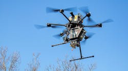
Based on the number of public safety agencies that received Federal Aviation Administration (FAA) Certificates of Authorizations (COAs) and Part 107 Waiver applications, there are at least 4,000 public safety unmanned aircraft system (UAS) programs that are operating in the United States. This number continues to grow exponentially, and in a 2020 study of operations in the country that was conducted by DroneResponders, at least 17 public safety UAS use cases were identified.
Even with all of this activity in the United States, there was no single place nor easy way for anyone to identify similar or nearby agencies that have a UAS program. This is unfortunate for everyone, because in areas where UAS teams are known to operate, regional groups tend to share information with each other and to train together. There is a general consensus that new UAS programs can grow more quickly when they have the opportunity to learn from other more advanced programs compared with if they lack access to that pool of information.
UAS program insight
In May 2021, DroneResponders, in a joint initiative with National Aeronautics and Space Administration’s (NASA) Ames Research Center, which is located in Moffett Field, CA, and Esri, which is an international supplier of geographic information system software, created a Global Public Safety UAS Program Directory and Map. The purpose of the directory is to share, collaborate, communicate and coordinate across disciplines on public safety UAS-related issues. Included among these are best practices, lessons learned, safety notices and regulatory updates. This also helps to identify public safety UAS resources for regional cooperation and mutual aid and to facilitate regional training opportunities for UAS programs, no matter where they are located in the country or the world, for that matter.
The program’s development keyed on uncomplicated access: Public safety UAS programs can register their information by utilizing a simple survey tool. The information is secure, and once the entry is made, it automatically populates on a global map.
Within two weeks of the directory’s launch, more than 300 agencies/departments from the United States and from countries abroad submitted their information. As a result, agency programs that are located around the world will be provided: program start date; number and type of missions flown, including COVID-19, damage assessment, firefighting, hazmat, swiftwater rescue and wildfires; operational payloads (i.e., AED delivery, cargo drop, coronal sensor, flotation device drop, gas detection, photo-imagery capture, thermal imaging, video streaming and zoom-capable); program capabilities; types of drones employed; number of pilots and other details. Information about a specific department/agency can be accessed by clicking on its symbol on the map.
The map’s dashboard allows filtering by public safety discipline (for example, fire service/EMS, emergency management, search and rescue, and law enforcement), state and more. Plans call for the addition of other layers of public safety UAS-related information as the database grows.
“The ability of GIS to capture, analyze and display data makes it an ideal platform for identifying where public safety drone programs are located and which geographic locations they can service,” says Brandon Karr, who is a national UAS subject matter expert for public safety applications and is the chief pilot for the Pearland, TX, Police Department. (Karr, who started Pearland’s UAS program, volunteers his time in support of the Global Public Safety UAS Program Directory and Map initiative.) “But not every public safety agency has an active drone program,” he tells Firehouse Magazine, “and those [public safety agencies] that do may not always have resources available for deployment. This will help.”
The Global Public Safety UAS Program Directory and Map are free for all to use and are open to all public safety disciplines.
Remote pilot directory
Also in May 2021, the Airborne International Response Team (AIRT), which is a Miami, FL-based 501(c)(3) nonprofit, nongovernmental organization (and which serves as the home to DroneResponders) initiated a Global Emergency Remote Pilot Directory. The expectation is that the directory, which will tap Esri geographic information system (GIS) software, will identify trained public safety remote pilots who might be available to help other communities during emergencies and major disasters and to aid in humanitarian missions.
“There are many public safety remote pilots around the world but no way to identify, recruit and deploy these new and valuable remote pilots,” Christopher Todd, who is the executive director of AIRT, says. “This tool will help to do just that.”
Todd also is a certified emergency manager and remote pilot.
“These two initiatives together will provide the means to enhance and promote public safety UAS resources around the world,” Todd further explains.
Todd told Commercial UAV News that AIRT’s original initiative in this vein lacked the proper workflow to evaluate all of the registrations—thus, the importance of Esri’s involvement.
“The great thing about the suite of tools that Esri brings to the table is we can create an array of options enabling public safety users to access the resource,” Todd told Commercial UAV News. “We will use georeferenced mapping products … to show where resources are located and information dashboards … to compartmentalize information and make it more digestible at scale.”
To register in the Emergency Response Remote Pilot Directory, submit your information to remotepilots.org.